| On this page |
The  HeightField Strata COP adds layers to a terrain. In nature, strata are the result of sedimentation processes. For example, in the oceans, there are tiny organisms with calcareous shells that are part of the plankton. After the organisms die, their shells sink to the seafloor and settle there. Over the course of many years, the shells compact and form a hard layer of limestone. The sedimentation rate is responsible for a layer’s thickness and also reflects climatic conditions.
However, sediments are not limited to oceans. In lakes or ponds you can observe similar mechanisms. There are also sediments from volcanic eruptions, forest fires, and cataclysmic events like tsunamis. And, you can find sediments from rivers that transport huge amounts of sand and gravel that is deposited in calmer zones or deltas. In deserts or post-glacial landscapes, sediments are also commonly found.

In tectonically active zones like the Alps, you can often see folded and bulged layers. Sometimes, the original order of the layers can even be reversed.
There’s also a difference between strata and terraces:
Strata (singular: stratum) refer to layers of rock formed by geological deposition processes over long periods of time. They typically lie on top of one another, are often millions of years old, and reveal information about past environmental conditions through their composition and fossils.
Terraces are topographic features, not layers. They form when a river or sea cuts into an older level, leaving behind flat, step-like ledges. Common types include river terraces and marine terraces.
Adding strata 
Strata are based on noise and you can see the underlying pattern when you connect a HeightField Strata COP’s height input with the layer output of a HeightField COP. In conjunction with a terrain you’ll get the typical “bands” around the mountains. Very small or very large values, however, can destroy the layers and the nature of the noise function becomes more apparent. In many cases, the default values are a very good starting point. For better a visibility of the layers, the  HeightField Noise COP’s Roughness was decreased to
 0.44.
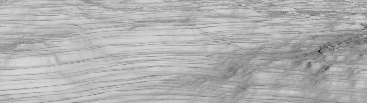
On the Pattern section, you can find a Strata Size parameter to control the height of the terraces. The value controls whether you will have more (higher) or less (lower) layers, but you can’t define a fixed number of terraces. The layers also have random height values. When you increase Strata Size, you’ll also notice that the layers start to blend with the terrain. At some point they're almost invisible. When you decrease size, on the other hand, you can see an “edge” or “bulge”. To counteract this behavior, go to the Pattern section and increase or decrease Amplitude. An with an Amplitude of 0, you won’t get any terraces at all.
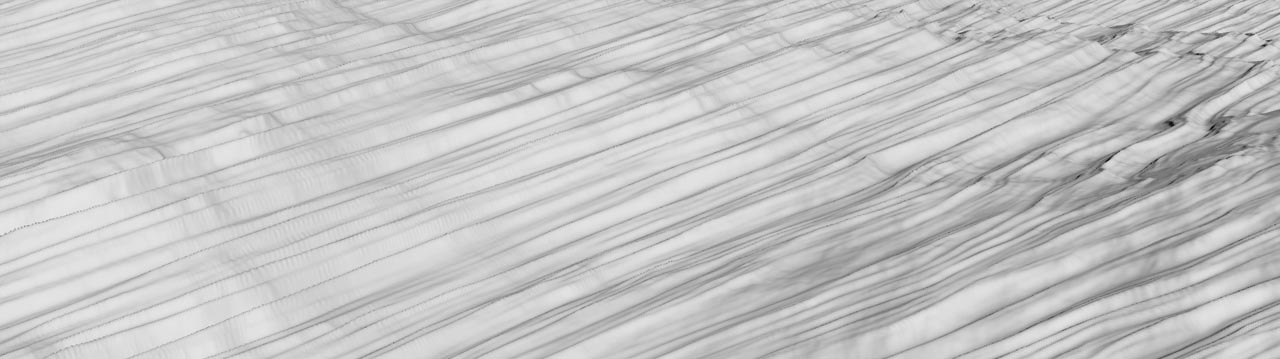
You can also add a Tilt to create non-horizontal terraces.
Layers 
The strata noise function creates a rather uniform look. However, in nature, you’ll hardly find a terrain with perfectly aligned terraces. The intention of the HeightField Strata COP’s Add Layers option is to create overlays that break the regular pattern. The more Layers you add, the more variation you’ll get. With five layers you already create a very realistic appearance.

Tilt Variance will also add variation to the horizontal position of the layers. Seed changes the noise pattern and you’ll get breaks, fissures, and edges in different areas.
Base height 
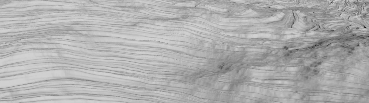
The strata node provides a baseheight input. There you can connect a noise node to distort the layers. To see an effect, it’s often necessary to work with high noise Amplitude and Element Size values on the distortion noise. For the irregularities in the image below, we used another HeightField Noise COP at the baseheight input with the default Amplitude and an Element Size of 850.
Masking 
When you add strata, the terraces are created over the entire terrain. In nature, terraces only appear in those area where the covering soil was eroded, or where rockfalls and landslides have occurred. A mask limits the occurrence of layers to certain parts of the heightfield.
You can use imported images, add a  HeightField Mask by Feature COP or one of the noise COPs. A feature mask takes specific terrain properties into account, for example slope or height.
The HeightField Strata COP has an extra input for a mask. Connect it with the output of the node that creates the mask. When you turn on the strata operator’s Display flag, you can see the result. The terraces are created in the non-black areas of the mask.
Erosion 
The finishing touch is erosion. This process blends the terraces with the terrain and makes them look realistic. Based on the terrain’s topography, you’ll see channels that cut through the terraces. The eroded material settles and smooths the surface. This results in softer terraces that blend with underlying rock. The art is to find a good balance between erosion features and the visibility of the terraces. The default values of the  HeightField Erode SOP often tend to erode the terraces completely. Especially with stacked erode nodes, you often end up with no layers at all. Masks can help to preserve the structures.
Strata as terrain 
You can achieve interesting terrain structures when you connect a HeightField Strata COP with an empty HeightField COP layer. The default strata node is based on a modified simplex noise. To create a landscape with cliff-like features and distortion, make the following adjustments:
-
Set Amplitude to
7to emphasize the noise pattern and create distinguishable structures. -
When you change Strata Size to
15, you can increase the distance between the noise bands. -
A Tilt value of
7rotates the noise patterns. On a flat heightfield, this parameters creates distortion. -
Turn on Add Layers and set Layers to a value of
7or higher to get more variation. -
Also change Roughness to
1to finally see a terrain. You can also play with Tilt Variance and Rotate Variance.
